At the Îles de Lérins, the organised anchorage is the Sainte-Anne ZMEL (organised mooring buoys): buoys from 1 May to 30 September for boats of 6 to 20 m, 3 knots, anchoring, bathing and diving prohibited (City of Cannes). Between the islands, 5 knots in the channels, 3 knots outside the channels; no anchoring in the ecomuseum area.
Sainte-Marguerite, Saint-Honorat and the underwater eco-museum: planning your stopovers, understanding the zones and making the most of your trip.
HeritageAnchoringSpeedsSwimming
Planning your trip. Published by SunSea Hub on 17 September 2026. Sources consulted on that date. The regulatory orders and maps are available via links on this page. Check the texts and recent notices before setting out.
NAUTICAL CHART
Getting your bearings around the islands
OpenSeaMap is a nautical chart for orientation, with buoyage and crowd-sourced information. It does not replace an up-to-date official chart or notices to mariners.
The town announces that boats from 6 to 20 m are accommodated from 1 May to 30 September. Check availability with the port of Moure Rouge.
In the ZMEL: 3 knots, anchoring prohibited; swimming, diving and fishing prohibited under order 238/2025.
STOP TO CHECK ON THE CHART
Between the islands
Distinguish anchoring areas from channels: no stopping in a passage reserved for transit. Check the restrictions and the seabed before dropping anchor.
The 3- and 5-knot limits apply to different zones, not to a single rule across the islands.
UNDERWATER VISIT · NO ANCHORING
Underwater eco-museum
South of Sainte-Marguerite, discovering the sculptures is planned with mask and snorkel when conditions allow.
Do not anchor in the museum zone. Arrange for the boat to stop outside the prohibited area and for suitable access.
Sources: Town of Cannes — Sainte-Anne, orders and sources detailed in the guide. The Croûton provisions do not apply to Sainte-Anne.
STOPOVER NOTEBOOK
The islands in pictures
Six visual landmarks for planning your stopover, from the panorama of the islands to the underwater eco-museum.
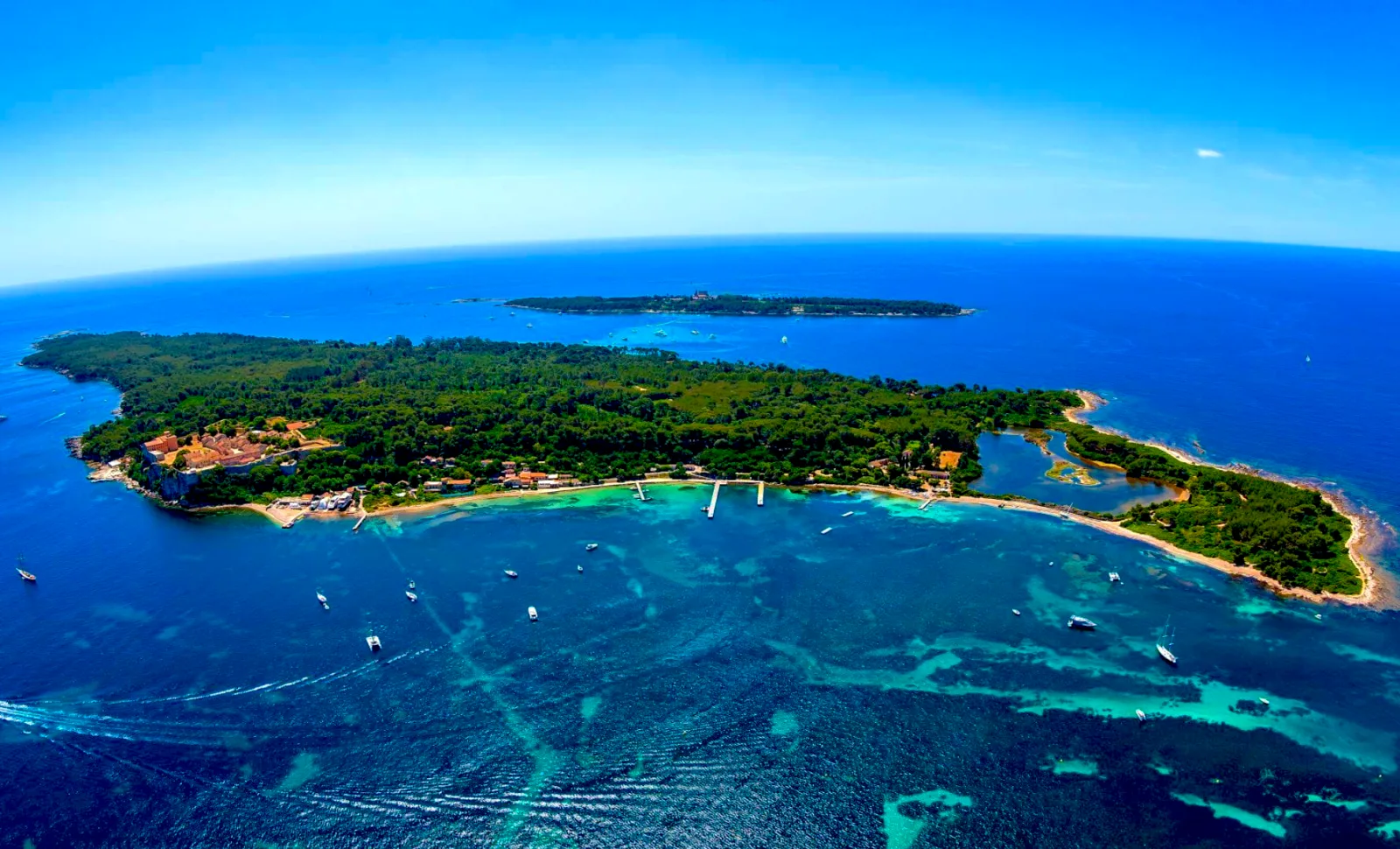
Overview of the islandsThe panorama that lets you locate the two islands before choosing your sailing programme.
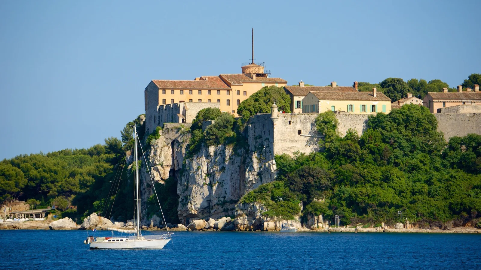
The Fort RoyalThe Fort Royal gives Sainte-Marguerite its face and remains a visual landmark from the Baie de Cannes.
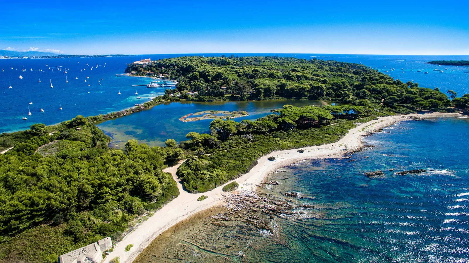
The Batéguier lagoonThe Batéguier lagoon is a reminder that Sainte-Marguerite is a fragile natural area: you observe it, without making it a stopping point by boat.
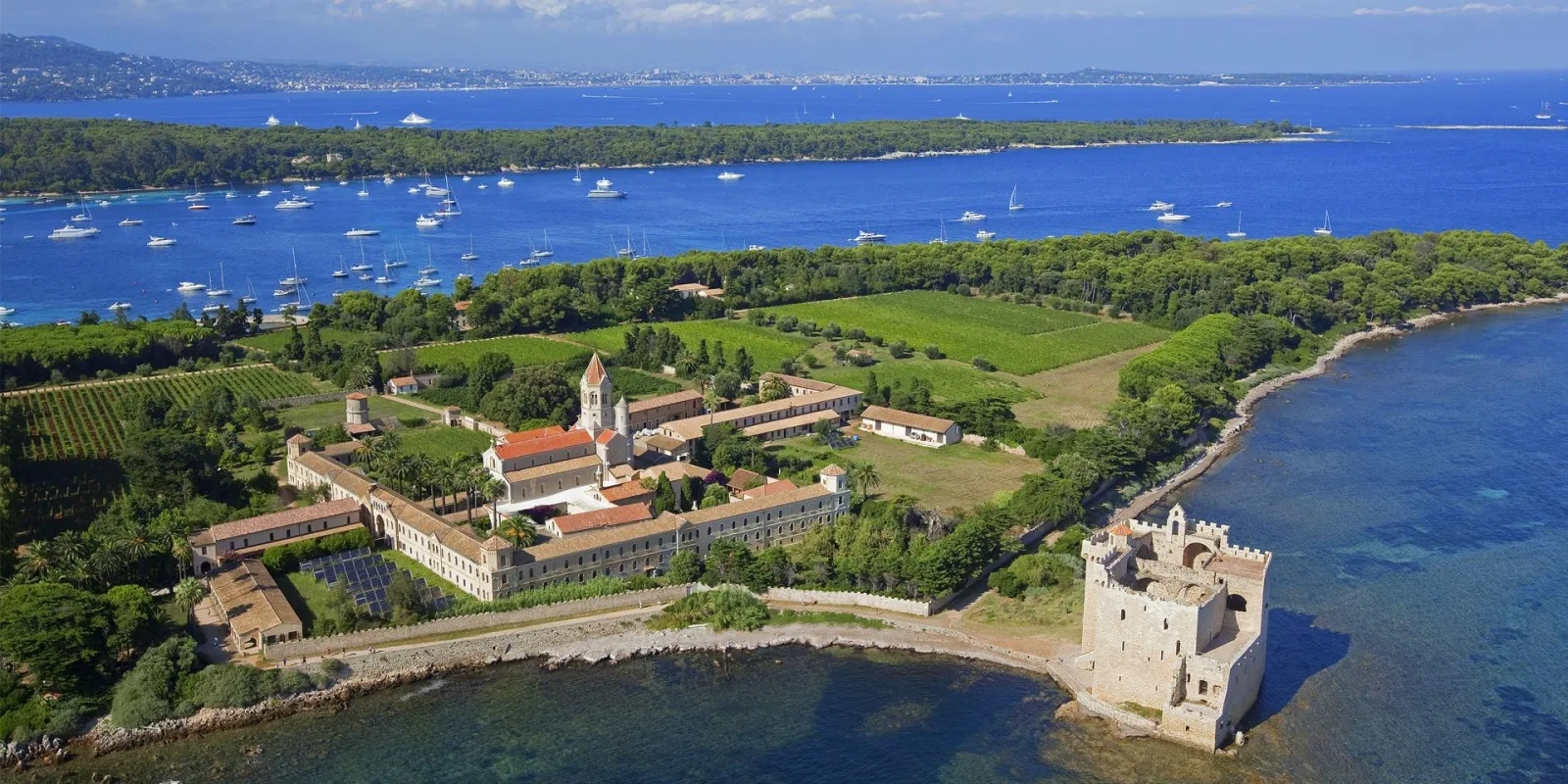
Saint-HonoratSaint-Honorat is recognisable by its vineyards, its abbey and its small forts: scenery to discover from a suitable distance.
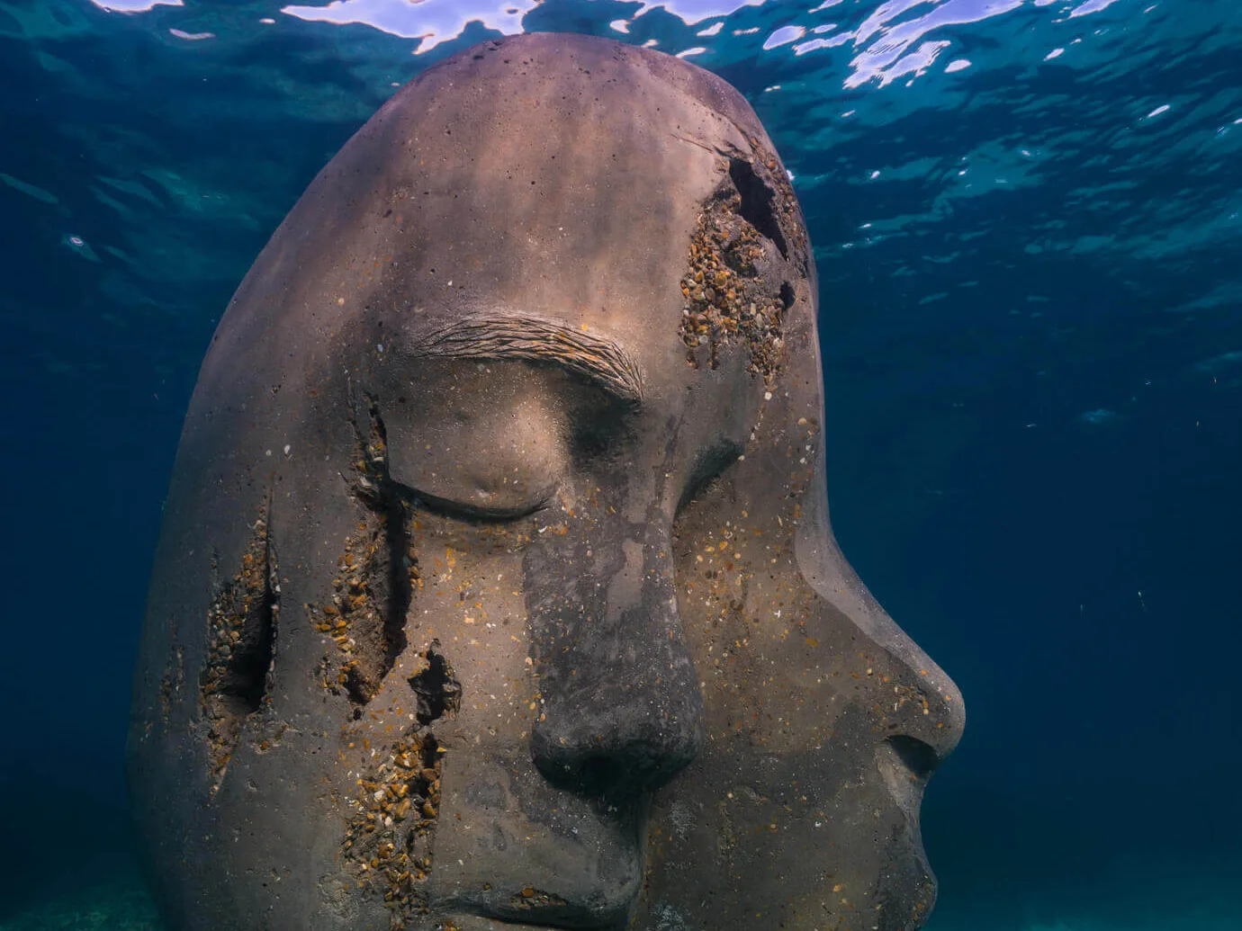
The underwater eco-museumThe six sculptures by Jason deCaires Taylor are discovered with mask and snorkel, without touching them or mooring the boat to them.
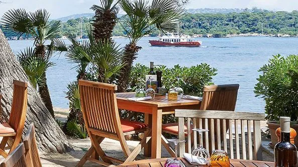
A gourmet stopoverFor lunch, a meal on board remains the most self-sufficient choice; an address ashore is checked directly with the establishment.
WATER ACTIVITIES
Activities from the boat or the shore
Ideas for enjoying the water from the boat or the shore, without turning a regulated zone into a place to practise them. The day’s conditions, the official chart and the buoyage always have the final say.
FROM THE BOAT
Choosing a safe spot to get in the water
Mask, snorkel or paddleboard are prepared from an authorised stop and away from swimming zones, mooring buoys and the Sainte-Anne ZMEL. For the eco-museum, keep the boat outside the prohibited area and adapt the activity to the current, the wind and the crew’s supervision.
FROM THE SHORE
Setting off from a suitable access point
On the islands, an activity can only be considered after a legally arranged arrival. A beach, a quay or a buoy does not amount to permission to land or to leave the boat without a crew member.
TO AVOID
Keeping a safety margin
In the Sainte-Anne ZMEL, the rules are specific: check the buoyage and the regulations before getting into the water.
Western Sainte-Marguerite: the Batéguier and the forest
After an organised landing, extend your visit to the Batéguier lagoon and its observatory. It is a stop for watching birds and discovering another side of the island, far from the usual beach-and-lunch programme. The town reports that the observatory has been renovated by the ONF (French National Forests Office). Stay on the paths and respect the peace of the site.
The Musée du Masque de fer et du Fort Royal (Man in the Iron Mask and Fort Royal Museum) completes the walk with the history of the fort and archaeological finds from land and sea. Check the opening hours and allow the time needed to return to your starting point. A visit to the museum requires a confirmed mooring or landing arrangement.
Between the islands: telling passage from stopping
The stretch of water between Sainte-Marguerite and Saint-Honorat combines navigation, swimming and stationary boats. Check the channels and zones shown on the official annex before choosing your spot. A clear space in the channel must remain available for passage; it is not an anchoring spot.
Do not choose the shortest route by relying only on the colour of the water: use the depths on your nautical chart and take your draught into account. The guide map describes rules; it does not provide a guaranteed navigation route.
Saint-Honorat: abbey, chapels and vineyards
Organise your walk around the monastic heritage: the abbey church, the fortified tower, the chapels and the vineyard landscapes. The island is home to a religious community; respect the areas open to visitors and the peace of the site. Check the visiting conditions for each monument before you leave.
Bring water and suitable shoes, then take your rubbish back to the mainland, as the community asks. The La Tonnelle restaurant, a simple break or a picnic let you adapt the programme to your day. Official Saint-Honorat information.
Three day ideas, whatever your port
Nature and heritage: confirmed berth for the boat, a walk to the Batéguier then a visit to the Fort Royal according to opening hours. Set aside time for the return before adding more visits.
Saint-Honorat on foot: an authorised stop at the Port des Moines according to the reception conditions, a walk and lunch. The length of the visit must remain compatible with that of the stopover.
Discovery from the sea: viewing the coastline, a stop in an authorised area suited to the conditions, a meal on board. A visit to the eco-museum is prepared separately, outside its no-anchoring zone.
The route, fuel consumption and return times depend on your base and the boat. Keep a fallback option if the reception or the weather do not allow the original programme.
Two islands, several ways to enjoy the sea
Off Cannes, the Îles de Lérins let you combine a boat trip with discovering heritage and the marine environment. Sainte-Marguerite and Saint-Honorat are visited differently: plan your programme by distinguishing what you can admire from the boat from the visits that require landing. This guide covers the area, whatever your port of departure. The length of your trip will depend on your base, your boat and the weather.
Sainte-Marguerite: a stopover between nature and history
The Fort Royal and the Musée du Masque de fer are two landmarks for a visit ashore. You can also devote part of the day to discovering the island. Before planning this stopover with your rental boat, check the reception and landing options: a landing stage served by shuttles is not necessarily accessible to private boats. Discover Sainte-Marguerite with the Town of Cannes.
Saint-Honorat: discovering the monastic island
Saint-Honorat is home to the Abbaye de Lérins, a fortified monastery and vineyards. This visit is prepared as a genuine stopover ashore: check the access arrangements and the island’s information before putting together your programme. The presence of a pontoon does not amount to permission to come alongside. Visit the Saint-Honorat website.
Where to have lunch on the islands?
Plan lunch at the same time as your stopover. Booking a table and organising the boat’s arrival are two separate steps. Opening times, menus and transfer arrangements change with the season; confirm them directly with the restaurant before setting off. Third option: stay at anchor and have a vendor boat deliver on board.
La Guérite — Sainte-Marguerite
A Mediterranean restaurant on the island, La Guérite indicates access by shuttle boat from the Port Canto harbour office, with a special departure from Mouré Rouge during the Cannes Film Festival. To arrive with your rental boat, ask the restaurant for the meeting point, the landing options and whether a transfer from your boat is available; the shuttle from Cannes does not guarantee this service. Contact: 04 93 43 49 30. Restaurant, booking and access.
L’Escale — Sainte-Marguerite
The Tourist Office presents L’Escale as a Mediterranean restaurant with a terrace and a view over the Baie de Cannes. It is an option for lunch during a visit to the island. Check the up-to-date contact details and confirm it is open; no transfer service from a private boat is confirmed in the source consulted. Official L’Escale listing.
La Tonnelle — Saint-Honorat
La Tonnelle offers a waterside lunch break on the Île Saint-Honorat. Its website lets you view the menu and book. To come with your boat, have the reception and any transfer confirmed before your trip; a restaurant booking does not reserve a berth at the Port des Moines. La Tonnelle website and booking. For a simpler break, the island’s website also presents the Les Canisses snack bar and picnic areas. Island information.
Delivery on board: the vendor boats
A third way to have lunch at the islands: stay at anchor and get delivered. Vendor boats serve the waters between Sainte-Marguerite and Saint-Honorat in season; you order, they come to you.
Vendor boat
L’apéro du pirate and L’apéro des Sirènes
Sharing platters, chilled cocktails and wines, sandwiches, bagels, ice creams.
Where: The Cannes basin, especially between the Îles de Lérins; delivery at the water’s edge or on board.
When: May to September, every day from 9 am to 9 pm, and on firework evenings.
Ordering: Call or text, then share your Google Maps position.
On board, when the vendor arrives: you stay on your buoy or at anchor, the vendor does the manoeuvring; have a line and a fender ready, keep the crew on board, cut the engine if anything is trailing in the water. Packaging goes back ashore with you: nothing is thrown into the sea. In the Sainte-Anne ZMEL, the zone’s rules (3 knots, no anchoring) apply to everyone, vendor included. Call first: this guide points out these services, it guarantees neither their presence nor their prices.
Landing at Sainte-Marguerite with your boat
The berthing order distinguishes how the pontoons are used. For pleasure boats, it designates the east side of no. 3 Sainte-Anne, except its northern end, no. 4 de la Commune, no. 5 des Lentisques and no. 8 La Guérite. No. 2, the west side of no. 3 and no. 3 bis are reserved for the professional vessels concerned. Berthing of boats for personal use is limited to six hours, with a 24-hour interval between two stays. Mooring must comply with the requirements of article 2. Check the signage, availability and local instructions before any approach: these provisions do not guarantee a berth for your boat. Berthing regulations, articles 1 and 2.
Landing at Saint-Honorat: the Port des Moines
The Town of Cannes states that the Port des Moines welcomes boaters for a short stop, all year round, for a maximum of six hours per 24 hours. Contact the maritime service on 04 97 06 42 73 to check the conditions for your boat. The marina and the shuttle landing stage must not be confused. Official Port Saint-Honorat information.
Reaching the islands by shuttle from Cannes
For Sainte-Marguerite, check the crossings by Trans Côte d’Azur or Horizon, departing from the Quai Laubeuf area. For Saint-Honorat, the island’s website offers tickets and timetables. Check which island you are arriving at and the time of the last return before buying. At the time of consultation, the town announces the closure of the Laubeuf car park for works: plan to arrive on foot from another car park. These services are an alternative to renting and are not transfers from a boat at anchor.
The underwater eco-museum: a visit to prepare
South of Sainte-Marguerite, six sculptures by Jason deCaires Taylor lie at depths of between 3 and 5 metres. The town presents a discovery with mask and snorkel and specifies that the works must not be touched or brushed against. Anchoring is prohibited in the museum zone. Arrange access without taking your boat into it or anchoring there; check the buoyage and conditions before getting into the water. Official presentation of the eco-museum.
Speeds: check which zone you are sailing in
Order 36/2016 sets 5 knots in the defined channels between the islands and 3 knots in the stretch of water it delimits outside these channels. It also sets 10 knots in a delimited part of the Cannes roadstead, beyond the 300 m coastal strip. These values relate to different areas: they must not become a single limit applied to the whole archipelago. Identify the area on the chart and follow the buoyage. Municipal navigation instructions.
Anchoring: plan your stop before you arrive
In the Anse Sainte-Anne, north of Sainte-Marguerite, the town announces a buoy mooring area open from 1 May to 30 September for vessels from 6 to 20 metres. Admission and conditions must be checked with the manager; the existence of the zone does not guarantee a spot. Contact given by the town: port of Moure Rouge, VHF 9, 04 93 94 37 71. The surrounding area includes anchoring bans: do not treat a free patch of water as an available anchorage. Published ZMEL conditions. The Sainte-Anne ZMEL is limited to 3 knots. Order 238/2025 notably prohibits swimming, diving and fishing there; anchoring is permanently prohibited, except in case of immediate danger. Read the ZMEL regulations.
Channels, swimming and buoyage
Order 167/2024 requires direct and continuous transit in its channels: stopping, anchoring and diving are prohibited there. It also prohibits mooring to navigation buoys. Its annex distinguishes swimming, motor restrictions, anchoring and other uses. Several provisions are seasonal and the text specifies the conditions linked to the placing of the buoyage. Read the full text and recent notices before departure.
Putting together your boat trip
First choose your priority: discovering the islands from the sea, a visit ashore or the eco-museum. Then plan the stopping conditions, access points and the return to your base. Ask your rental company to check that this programme suits the boat booked and the forecast conditions. Distances and durations will be specified according to your port of departure; no navigation route is imposed by this guide.
Before leaving port
Check the marine forecast and the day’s notices to mariners; confirm local restrictions and reception options; keep a margin for the return. The absence of a rule on this page means neither free navigation nor authorised anchoring. This guide helps you prepare a trip and does not replace up-to-date nautical documents.
Nearby fuel stations
Cannes: Vieux-Port and Pierre Canto. Confirm which fuel berth is open and the entry instructions before leaving the islands.
The zones below are those laid down by the orders and regulations cited, with their coordinates where the text gives them (the centre of the zone when the order describes a polygon). The text in force and the buoyage on site always prevail.
Mooring buoys (ZMEL)
ZMEL (organised mooring buoys) of the Anse Sainte-Anne (north of Sainte-Marguerite)
30 free buoys for vessels of 6 to 20 m, from 1 May to 30 September, no booking: report on arrival to the Port du Mouré Rouge (VHF 9).
11 buoys for 6–8 m, 8 for 8–12 m, 7 for 12–15 m, 4 for 15–20 m; 7 consecutive nights at most, 21 per season, two nights between two stays; departure before 12 noon (order 238/2025)
3 knots; anchors, swimming, diving, fishing, personal watercraft (jet skis) and paddleboards prohibited; entering and leaving under sail prohibited; departure compulsory as soon as force 6 is announced (order 238/2025)
Black-water tanks compulsory; on arrival: sanitary declaration, identity document, ship’s papers and wreck-removal insurance (order 238/2025)
Report on arrival to the Port du Mouré Rouge office (VHF 9 or telephone); after 6 pm: the next day from 9 am; anchor lights at night (order 238/2025)
Contact: VHF 9 · 04 93 94 37 71 (9 am–6 pm) · portmourerouge@ville-cannes.fr, Port du Mouré Rouge office (City of Cannes) · 43°31.53′ N, 7°02.37′ E (approximate position)
Coordinates: centroid of the six vertices A–F of the order. 5 ha zone at the heart of a 43 ha no-anchoring zone (City of Cannes). Hull cleaning, oil changes, refuelling and discharges prohibited.
Delivery on board possible in season: vendor boats serve the waters around the islands. You stay at your mooring, the vendor comes to you. See the services.
Mooring buoys for large yachts
Mooring buoys for large yachts A, B, C, D around Sainte-Marguerite (order 228/2022)
Four mooring buoys for large yachts of 24 to 45 or 70 m; within the regulated circle (120 m or 50 m), anchoring by vessels < 24 m, swimming and diving prohibited.
“4 mooring buoys intended to accommodate yachts with an overall length of 24 metres to 45 and 70 metres respectively” (order 228/2022)
Buoy in place: anchoring by vessels < 24 m and craft of all kinds (including fishing) prohibited; swimming and diving permanently prohibited (order 228/2022)
On the buoy: watch on VHF 16 (or DSC 70), AIS switched on, crew ready to get under way; underwater floodlights, fireworks and discharges prohibited (order 228/2022)
Reminder: anchoring by vessels ≥ 24 m permanently prohibited around Sainte-Marguerite (order 205/2020) (order 228/2022)
43°31.63′ N, 7°02.63′ E
Coordinates: buoy A (north of the island, east of the ZMEL (organised mooring buoys)), 120 m circle. Buoy B (east, towards the Tradelière) 43.52122/7.06788, 120 m circle; C (south-east) 43.51378/7.06088, 50 m circle; D (west, between the two islands) 43.51493/7.03517, 50 m circle. Copy of the order hosted by the port of La Napoule, original not located; operator and fees not stated.
Delivery on board possible in season: vendor boats serve the waters around the islands. You stay at your mooring, the vendor comes to you. See the services.
Large-yacht anchoring zone (ZOM)
ZOM “Cannes Est – Portet anchorage” (large yachts)
Mandatory anchoring zone for vessels ≥ 45 m or ≥ 300 GT, between Sainte-Marguerite and Pointe Croisette; 10 knots for all when one of them is present.
Mandatory anchoring zone for vessels subject to anchoring authorisation (order 157/2024)
10 knots for all when a vessel subject to the obligation is present (order 157/2024)
43°31.75′ N, 7°03.65′ E (approximate position)
Coordinates: centroid of vertices I–S. The data read do not indicate an express prohibition for other vessels (unlike Pampelonne, art. 5.2).
No anchoring
Anse Sainte-Anne – anchoring ban around the ZMEL (organised mooring buoys) (points 1 to 5)
Anchoring by all vessels is permanently prohibited around the ZMEL (organised mooring buoys), between points 1 to 5 and the coastline (43 ha according to the City).
“Anchoring by all vessels is also permanently prohibited around the mooring sectors of the ZMEL (organised mooring buoys)” (points 1 to 5) (order 238/2025)
43-hectare no-anchoring zone around the ZMEL (organised mooring buoys) (City of Cannes)
43°31.53′ N, 7°02.16′ E (approximate position)
Coordinates: centroid of points 1–5; the zone is closed by the island’s coastline, so the centroid falls slightly north of the true centre.
No anchoring
Grand Jardin underwater eco-museum (south of Sainte-Marguerite) – permanent no-motor zone (ZIEM)
Permanent no-motor zone (ZIEM) above the submerged sculptures: navigation and anchoring by motorised craft prohibited, diving prohibited.
No-motor zone (ZIEM) “on a permanent basis, south of the Île Sainte-Marguerite, in which sculptures are submerged” (order 251/2026)
Navigation and anchoring by motorised craft prohibited; scuba diving prohibited (art. 2) (order 251/2026)
43°30.92′ N, 7°03.01′ E (approximate position)
Coordinates: centroid of points A–D (zone closed by the coastline).
No anchoring
South of the Île Saint-Honorat (Lérins abbey) – no-anchoring zone (ZIM)
Zone closed to anchoring, whatever the type of anchoring, south of the Île Saint-Honorat (points A, B, C).
“Anchoring by registered vessels, boats and craft, whatever the type of anchoring, is prohibited there” (order 251/2026)
Zone defined by points A, B, C south of the island (art. 1.6) (order 251/2026)
43°30.30′ N, 7°02.77′ E (approximate position)
Coordinates: centroid of points A–C.
No anchoring
North-west of Sainte-Marguerite – landing-stage no-anchoring zone (ZIM) (114/2020) and “fishing nets” ZIM (36/2016)
No-anchoring zone (ZIM) of the landing-stage pontoons (mooring perpendicular to pontoons 2 to 5) and four ZIM created for the setting of fishing nets near the islands.
No-anchoring zone (ZIM) north-west of the island (order 114/2020): mooring at pontoons no. 2 to 5, stern-to or bow-to, is perpendicular to the pontoons (order 251/2026)
“By prefectoral order no. 36/2016 of 22 March 2016, four no-anchoring zones (ZIM) are created, on account of the setting of nets” (order 251/2026)
The PDF of order 36/2016 published by the City of Cannes is a scan without text: the coordinates of the four no-anchoring zones (ZIM) could not be read. No coordinates for ZIM 114/2020.
No anchoring
Between the islands and Cannes bay – personal watercraft (jet skis) prohibited
Personal watercraft (jet skis) prohibited within 300 m of the islands, in Cannes bay and on the stretch of water between Sainte-Marguerite and Saint-Honorat.
Personal watercraft (jet skis) prohibited within 300 m (islands included) and in Cannes bay between the lines harbour south jetty – Batéguier and Palm Beach – Fort Ste-Marguerite (order 251/2026)
Stretch of water between the islands: from the Pointe du Dragon – Pointe du Barbier line to the Tradelière south – Saint-Féréol north line (zones of order 36/2016) (order 251/2026)
Navigation restriction, not an anchorage. Lines: Pointe du Dragon 43°31.066’N – 007°02.068’E, Pointe du Barbier 43°30.445’N – 007°02.201’E; Tradelière south 43°30.868’N – 007°04.396’E, Saint-Féréol north 43°30.415’N – 007°03.523’E.
Frequently asked questions
Can you drop anchor in the Anse Sainte-Anne?
No: in the Sainte-Anne ZMEL (organised mooring buoys), anchoring is permanently prohibited except in immediate danger, and order 238/2025 also prohibits bathing, diving and fishing there. You pick up a buoy, at 3 knots; contact: Moure Rouge harbour, VHF 9, 04 93 94 37 71.
What is the speed limit between Sainte-Marguerite and Saint-Honorat?
Order 36/2016 sets 5 knots in the defined channels between the islands and 3 knots in the waters it delimits outside those channels; it provides for 10 knots in part of the Cannes roadstead, beyond 300 m.
Can you land at Sainte-Marguerite with your boat?
On the pontoons designated for pleasure craft (east side of no. 3 Sainte-Anne except its northern end, nos. 4, 5 and 8), six hours at most with 24 hours between two stays. At Saint-Honorat, the Port des Moines allows a stop of six hours at most per 24 hours.
 SunSea Hub / Cruising guide