Cap d’Antibes by boat: scenery, stopovers and anchoring
Published by SunSea Hub. Sources consulted on 17 September 2026.
CHARTS AND ORIENTATION
See the cape, its access points and its regulated zones
Two complementary readings: locate the places, then check the official buoyage before choosing an approach or an anchorage.
Nautical chart of the cape
OpenSeaMap: a nautical chart for orientation, with buoyage and crowd-sourced information. It does not replace the up-to-date official chart or the day’s notices.
The regulatory documents remain available via link, so that you can check their edition year and conditions of application directly.
To navigate: use an up-to-date official nautical chart with soundings and buoyage. The 2-nautical-mile line from the coast has not been drawn yet; it must not be presented as a legal limit for distance from a shelter.
PLANNING YOUR STOP
Anchorages and stopover options
BUOYS · PUBLISHED RULES
Anse du Croûton
Mooring on the equipment provided. Anchoring prohibited in the ZMEL and the associated no-anchoring zone.
47 buoys in summer, 9 in winter.
No booking, subject to availability.
24 hours maximum, then 48 hours before a new stay.
Registration by QR code; respect the buoy’s capacity.
Before considering a stop, check the buoyage plan: swimming, channels and anchoring restrictions. Choosing a spot is not only a matter of available space.
Assess exposure and the seabed with a nautical chart. Access to the restaurant or to the shore must be confirmed separately.
A cove worth discovering, without treating the presence of boats as permission to anchor. Check the restrictions, the type of seabed and the sea conditions before any stop.
No authorised anchoring area is invented on this page.
A stop ashore? Prepare a request to Port Gallice, or contact the manager of the port you have in mind. A table booking does not reserve a berth in the port.
The Garoupe and Baie des Milliardaires entries point out the checks required; they do not designate authorised anchoring zones. Municipal sources consulted on 17 September 2026.
STOPOVER NOTEBOOK
The cape in pictures
Six visual landmarks to locate the cape, the organised moorings and the stopovers around Antibes.
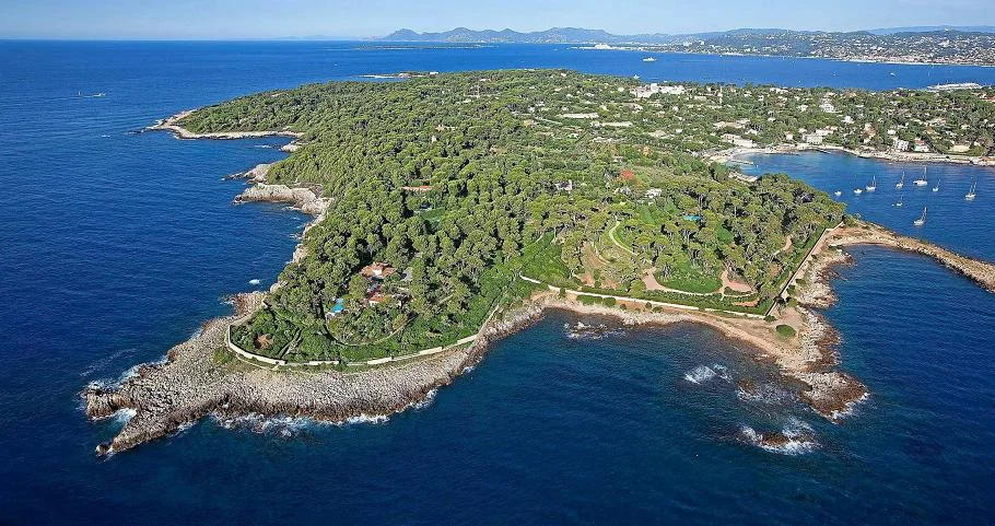
Overview of the capeThe cape, the Garoupe and the islands in the background: a useful panorama for getting your bearings on the coastline before setting out.
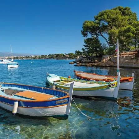
L’Olivette and its pointusA traditional harbour of refuge, to be seen as a place to visit and not as an open manoeuvring area.
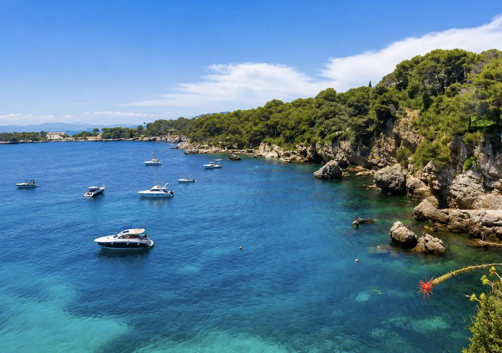
Baie des MilliardairesA spectacular rocky cove: keep the seabed, the swell and swimmers in mind when preparing your approach.
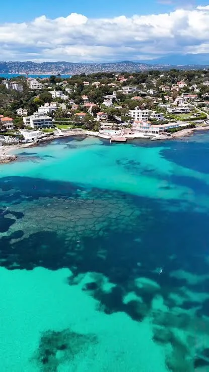
The GaroupeClear waters and the cape’s coastline: scenery that never exempts you from checking the day’s rules.
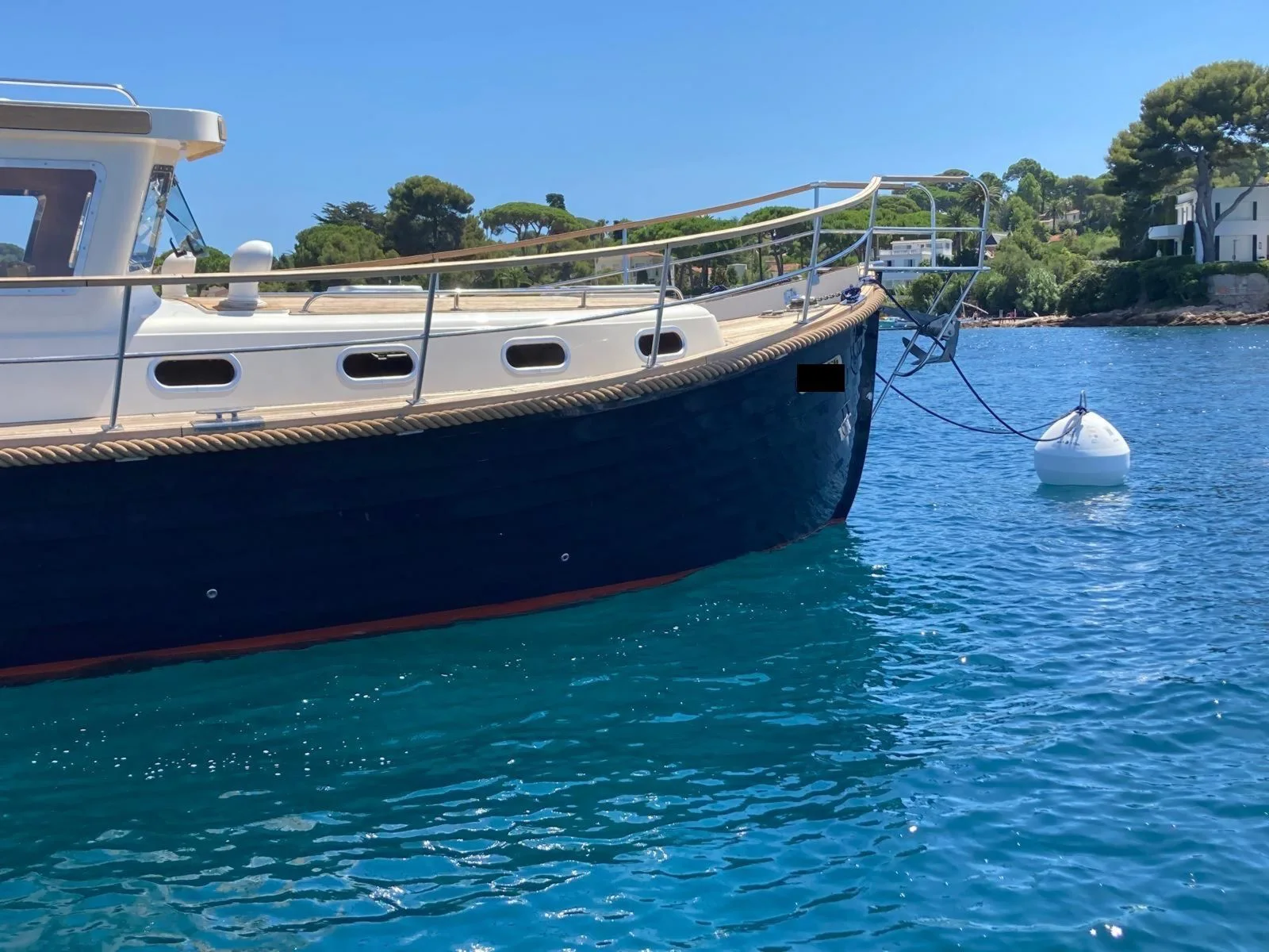
Le CroûtonThe buoys and the boats at anchor are a reminder that stopping is organised according to the rules of the zone.
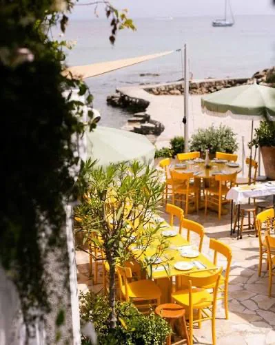
A gourmet stopoverA meal on board remains the most self-sufficient option; a table ashore is confirmed directly with the establishment.
WATER ACTIVITIES
Activities from the boat or the shore
Ideas for enjoying the water from the boat or the shore, without turning a regulated zone into a place for activities. The day’s conditions, the official chart and the buoyage always have the final say.
FROM THE BOAT
Choosing a safe place to get into the water
The cape’s rocky shores lend themselves to observation and snorkelling when the buoyage, the sea and the chosen area allow. The skipper stays on board and the boat never stops in a swimming zone, a channel or a buoy field.
FROM THE SHORE
Setting off from a suitable access point
From the shore, Posidonia offers guided activities according to its programme, including snorkel trails and kayaking. This offer does not provide boat access: the arrival and berthing of your boat are arranged separately.
TO AVOID
Keeping a safety margin
Do not launch from port access points or across swimming zones; check the channels, buoys and weather before taking out the paddleboard.
Discovering the cape from the sea
A trip around Cap d’Antibes lets you discover several moods of the coastline, between the Juan-les-Pins area, the tip of the cape and the Garoupe. Plan your programme according to the boat and the day’s conditions: a full circuit is not necessary to enjoy the scenery.
This guide does not depend on your port of departure. The choice of route, distances and return time must be adapted to your base. No line drawn on a tourist map should be followed as a nautical route.
Getting your bearings around the cape
The western side faces the Golfe-Juan bay and Cannes; the eastern side faces Antibes and the Baie des Anges. The south of the cape links these two settings with a rocky coastline. First choose the side suited to the day’s conditions, then the visits and the restaurant: calm water at departure does not necessarily describe the other side of the cape.
To prepare your visit, here are the main areas to identify:
Juan-les-Pins side: Port Gallice, the Croûton cove and port, the Olivette harbour of refuge, Plage des Ondes.
Towards the south: the Graillon battery and Posidonia, the Eden-Roc area, Baie des Milliardaires and the Eilenroc estate.
East side: the Tirepoil coastline, the Garoupe, the Bacon area, La Salis and Le Ponteil.
To extend your stopover: Antibes old town and Port Vauban, north of the cape.
This list is a tourist overview, not a sequence of waypoints to follow close to the shore.
Juan-les-Pins and Gallice: activities near the water
The Gallice, Croûton and Juan-les-Pins area is first and foremost a place to read the traffic, the buoys and the channels. For a swim, snorkelling or paddleboarding from the boat, choose an area that is genuinely available after checking the buoyage; a free spot or a buoy is not enough.
A table or a welcome ashore is arranged separately, after confirming a stopover at Port Gallice. The guide does not recommend landing from a beach or an anchorage. Request a stopover at Gallice.
L’Olivette and Les Ondes: the cape’s small landscapes
L’Olivette is a harbour of refuge for pointus (traditional boats), interesting for its traditional character. See it as a place to discover and photograph; its small size and occupied berths do not mean it can welcome a rental boat. The town presents the history of these harbours of refuge and their scenery in its postcards of the coastline.
Plage des Ondes is another scenic stop on the western side. Being close to a beach means looking out for swimmers and the buoyage before any approach. To go ashore, have authorised access confirmed; do not cross a swimming area in a motorised tender. Plage des Ondes — Town of Antibes.
Le Graillon and Posidonia: discovering the marine environment
The Graillon battery is home to Posidonia, Espace Mer et Littoral, on a natural site combining pine forest and rocky shoreline. It is a worthwhile family visit for understanding the cape’s landscapes and habitats. The centre offers guided discovery activities, notably snorkel trails or kayaking depending on its programme.
A visit is arranged with Posidonia, independently of where the boat is berthed. The existence of a water activity on the site does not mean that a visitors’ pontoon is available. Posidonia’s official programme and access.
Baie des Milliardaires: the Anse de l’Argent-Faux
This is one of the places that was missing from the guide: Baie des Milliardaires, also called Anse de l’Argent-Faux, lies at the foot of the Eilenroc estate. It is worth identifying for its cove and rocky-coast scenery. Heritage presentation by the town.
Plan this visit as viewing from the sea, then decide on a possible stop after reading the nautical chart, the buoyage and the anchoring rules. Its well-known name and the presence of other boats prove neither that you may drop anchor nor that the anchorage is safe in the day’s conditions. No public landing stage usable by your boat is confirmed here.
The Garoupe: scenery to discover, a stopover to organise
The Garoupe combines a beach, a plateau and a lighthouse. From the sea, enjoy the scenery while staying outside the areas reserved for swimming. Visiting the lighthouse requires an organised stop ashore: its presence in this guide does not mean that landing on the beach is permitted.
The lighthouse welcomes visitors; conditions and opening hours are available on the Town of Antibes website.
Dated information — September 2026: the Tourist Office announces that works at the Garoupe resume on 7 September, with changes to traffic on land. Check its update before planning a visit: these works alone do not imply any navigation restriction. Official information on the beaches.
Tirepoil, La Croë and Eilenroc: viewing them from the sea
These landmarks on the south coast help you plan a sightseeing cruise from offshore. They are neither a landing area nor an invitation to run close along the rocks.
When conditions and the buoyage are favourable, the crew may choose a swim break in a suitable area, keeping an easy return to the boat. Otherwise, enjoy the cape as scenery and carry on to an authorised zone.
Bacon, La Salis and Le Ponteil: heading back to Antibes
On the eastern side, the Bacon area lets you continue your discovery towards La Salis and the beaches near the town. La Maison de Bacon is a restaurant to consider after an organised arrival ashore. For La Salis and Le Ponteil, check the buoyage before your approach: the tourist appeal of the beaches does not constitute permission to navigate there by boat. The beaches — Tourist Office.
The port of La Salis, at the foot of the Garoupe hill, should not be confused with the beach of the same name. Contact its manager to find out whether your boat can be accommodated; no visitor berth is guaranteed by this guide. Official presentation of the port of La Salis.
Anse du Croûton: an organised mooring area
The town describes an area equipped with buoys and a ban on free anchoring in the ZMEL and the associated prohibited zone. Buoy availability and capacity must be checked on site.
The published municipal conditions provide for a maximum stay of 24 hours, then 48 hours before mooring again, as well as registration by QR code. They indicate use without booking, subject to availability. Do not pick a buoy without checking its capacity and the manager’s instructions.
Speeds, swimming and navigation: reading the different zones
The municipal portal indicates a 5-knot limit in a defined zone around Le Croûton. It also shows the channels, the no-motor zones and the anchoring bans in the buoyage plan. This value must not be extended to the whole cape.
To prepare your trip, open the map and the texts from the official “Mouillage et plaisance” (anchoring and boating) page. The rules may depend on the area and the boat’s characteristics. An area not covered in this guide is not an area free of all restrictions.
Restaurants: planning lunch and the boat’s arrival
At the Garoupe, Plage Keller and the restaurant Le César offer a stop ashore. The establishment’s website shows pontoons, but this does not guarantee their availability for your boat: have the arrangements for arrival, landing or transfer confirmed when booking.
On the Juan-les-Pins side, the Plage Belles Rives restaurant is another option. The establishment describes a private landing stage in its documentation; contact it for the current access conditions and whether your boat can be accommodated. No transfer from an anchorage is presented here as guaranteed.
Other addresses to include in your programme:
BABA — Cap d’Antibes Beach Hotel: beach restaurant between Gallice and Le Croûton. Booking and opening times on the establishment’s website. Boat access or transfer to be confirmed.
Les Pêcheurs — same hotel: an option for dinner ashore. Check the service times and whether a return is compatible with your rental. Official website.
La Maison de Bacon — Bacon area: a restaurant focused on seafood. Access from your stopover must be organised on land; no pontoon or transfer boat is confirmed in this guide. Official website and bookings.
Before booking: say that you are arriving by boat, give its length, the number of passengers and your arrival time. Ask whether the establishment actually offers a transfer that day, from which point, at what price and with what weather limits. Ask whether the boat stays at anchor and who keeps watch over it. Without a confirmed solution, plan a stopover in port or a meal on board.
For these addresses, check opening times, menus and availability directly with the establishment. A table booking is not a mooring booking.
Going ashore: organising a stopover in port
Port Gallice offers a stopover booking request for short or long stays. This is a separate step from booking a restaurant. Wait for the port’s confirmation and check that the berth matches your boat’s dimensions and draught before planning your visit ashore.
Anchoring, Posidonia and large vessels
Anchoring regulations are not just about distance from the beach. The municipal portal presents specific zones and rules, notably for vessels of 24 metres and over. This category must not be mistakenly applied to all boats; conversely, being smaller does not exempt you from other local bans.
Before dropping anchor, check the authorised area and the type of seabed. Favour an identified sandy area where anchoring is permitted, with a chain that will not sweep the seagrass meadows. In the Croûton ZMEL and the associated no-anchoring zone, do not replace an unavailable buoy with your anchor. Regulations published by the town.
Hazards and conditions: preparing to round the cape
Change of exposure: as you approach a point, reassess the wind, the swell and your return. A beautiful cove is not necessarily a suitable shelter for your boat.
Rocky coast: use the soundings and hazards on your up-to-date nautical chart. This guide provides neither an approach route nor a guaranteed minimum depth.
Swimmers and water activities: keep a careful lookout near beaches, boats at anchor and activity starting points. A person in the water is hard to spot from the helm.
Port entrances and channels: avoid stopping in them and follow the port instructions and the buoyage in place.
Return: keep a margin of fuel, daylight and time, including if lunch runs late or if your planned stop becomes impossible.
Three trip ideas to adapt to your port
Scenery and a break on board. Choose the side that suits the weather, discover a few places without multiplying approaches and settle on a stop only after checking the conditions and the rules.
Snorkelling or paddleboarding in a clearly marked area. Prepare the equipment, designate the person who watches the boat and give up if the buoys, the traffic or the sea leave no margin.
A guided activity from the shore. For a guided snorkel trail or kayak outing, start from an access point or an organisation that runs it, without making the programme depend on an unconfirmed landing.
No fixed sailing time is given: it depends on the port used, the boat, the sea and the restrictions encountered.
Mistakes to avoid
Choosing an anchorage only because other boats are there.
Mistaking a navigation buoy for a mooring buoy.
Planning to land on a beach without checking access points and reserved areas.
Assuming both sides of the cape are equally sheltered whatever the conditions.
Using the future 2-nautical-mile line from the coast as proof of distance from a shelter.
Before you leave
Check the marine forecast, notices to mariners, temporary restrictions, arrival conditions and your margin for the return. Have your rental company confirm that the planned trip suits the boat and the forecast conditions.
Guide map
The maps can be found at the top of the guide: base map, official buoyage plan and location map of Le Croûton. External documents require a connection. No regulatory boundary has been roughly redrawn. The bathymetric layer and the 2-nautical-mile line have yet to be added.
Nearby fuel stations
Port Gallice, Port Vauban and Golfe-Juan: the three options closest to the cape. Access depends on traffic and each port’s instructions.